
|
Chaparral Pea
Pickeringia montana var. montana
First posted August 1, 2004 Last updated
August 1, 2004

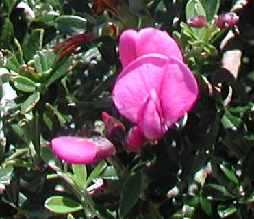
Chaparral pea in bloom
Photo taken on the Loop Trail, Mt Tamalpais
State Park, July 31, 2004, David Nelson
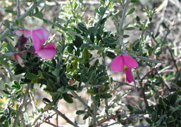
The chaparral pea is, as its name implies,
one of the plants of the chaparral community. It is
a spiny dark green shrub, with leaves in leaflets of
3, less than 1/2" (1.3 cm) long, stiff, broadly
lanceolate. It often forms impenetrable thickets (which
is typical of the chaparral biozone), with the bright
reddish-lavender flowers you see above. They are about
3/4" (2 cm) long and have a remarkable resemblance
to the flower of the common pea, hence its common name.
Its Latin name honors Charles Pickering (1805-1878)
of the Philadelphia Academy of Sciences who came to
California with the Wilkes Expedition as a physician
and botanist (ref. genus Pickeringia), and the "montana"
simply means "of the mountains." The fuit
is a peapod, about 1 1/4-2" (3.1-5 cm) long, flat,
straight. The chaparral pea is found in open woodlands
and washes, dry slopes and ridges, mostly chaparral
to 5000'. Its Blooming period is May to August.
This shrub flowers from May-August (these
photos were taken July 31). It is distributed in the
Coast Ranges from the Santa Monica Mountains north to
Mendocino County, and in the foothills of the Sierra
Nevada from Nevada County north to Butte County. It
is also found on Santa Cruz Island. It is the only species
in a genus confined to California ("endemic"),
so it contributes to the state’s unique flora.
Rarely reproducing from seed, it grows new stems from
roots that spread, especially after fires.
We have not yet found chaparral pea on
the Caz property, but expect to find it in the upper
acers, with further exploration. These photos are from
Mt Tamalpais State Park, which has the best chaparral
plants in the region, and yet is part of the redwood
forest. It is well worth a visit. Take the Loop Trail,
which is only 0.7 miles long and level, taking a counterclockwise
path around the top of Mt Tam.
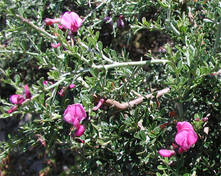 
Chaparral pea in bloom
Photos taken on the Loop Trail, Mt Tamalpais
State Park, July 31, 2004, David Nelson
References
There is a great photograph of chaparral pea in bloom
on Michael
Charter's site.
More can be found on the eNature
website.
US
Forest Service citation.
Acknowledgments
eNature (cited above) and the US Forest Service (cited
above).
|
|